This & That Saga and Serendipity. Memoirs and Musings.Prof. Aloke Kumar
Prof. Aloke Kumar

In that Empire, the Art of Cartography attained such Perfection that the map of a single Province occupied the entirety of a City, and the map of the Empire, the entirety of a Province. In time, those Unconscionable Maps no longer satisfied, and the Cartographers Guilds struck a Map of the Empire whose size was that of the Empire, and which coincided point for point with it. The following Generations, who were not so fond of the Study of Cartography as their Forebears had been, saw that that vast map was Useless, and not without some Pitilessness was it, that they delivered it up to the Inclemencies of Sun and Winters. In the Deserts of the West, still today, there are Tattered Ruins of that Map; in all the Land there is no other Relic of the Disciplines of Geography than a map.

Suárez Miranda, Viajes de varones prudentes, Libro IV, Cap. XLV, Lérida, 1658 ― Jorge Luis Borges
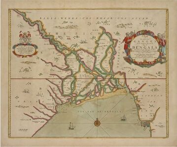
2.	Map of the Ganges flowing into Bengala. A nautical map showing highly detailed navigation information of the coasts of India for the benefit of mariners. These were compiled by John Thornton, Hydrographer to the East India Company London. Dated:  1715.
Map of the Ganges flowing into Bengala. A nautical map showing highly detailed navigation information of the coasts of India for the benefit of mariners. These were compiled by John Thornton, Hydrographer to the East India Company London. Dated:  1715.
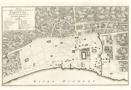
3.	Calcutta. Battle Plan for the Intelligence of the Military Operations at Calcutta When Attacked and Taken By Seerajah Dowlett. This Map is very importantas it depicts the Old Fort William as it existed in 1756, as the British faced the onslaught of the Bengal Army led by Nawab Sirajud Daula (spelled Seerajah Dowlet in this map). Dated : 1756.
Calcutta. Battle Plan for the Intelligence of the Military Operations at Calcutta When Attacked and Taken By Seerajah Dowlett. This Map is very importantas it depicts the Old Fort William as it existed in 1756, as the British faced the onslaught of the Bengal Army led by Nawab Sirajud Daula (spelled Seerajah Dowlet in this map). Dated : 1756. 
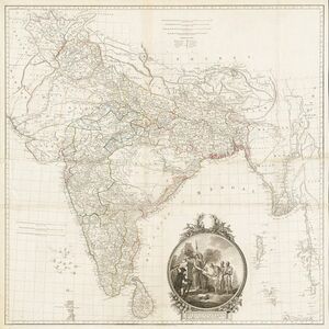
Map of Hindoostan, by James Rennell. Rennell’s cartographic surveys were a decisive turning point in this regard. Although obliged to leave India in 1777 on account of ill-health, Rennell blazed a trail which others followed. Dated: 1782.
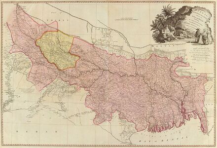
A map of Bengal, Bahar, Oude & Allahabad - James Rennell - William Faden. James Rennell. Rennell and his four assistants in the eighteenth-century created a vast collection of maps which later came to employ nearly 150 Europeans besides a large army of native Publisher: William Faden. London, 1786.
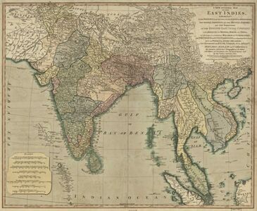
A new general map of the East Indies - exhibiting in the Peninsula on this side of the Ganges, or Hindoostan, the several partitions of the Mogul's Empire and the dominions of the English East India. James Rennell. Dated: 1794.
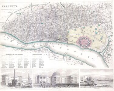
Map of the City of Calcutta. The lower part of the map is decorated by several beautiful engraved illustrations of important Calcutta locations, including the Government House, Esplande Row, and the Writer’s Buildings. As much as possible individual streets are indicated as are souks and bazaars. Published by Chapman and Hall of 186 Strand Street in November of 1842.
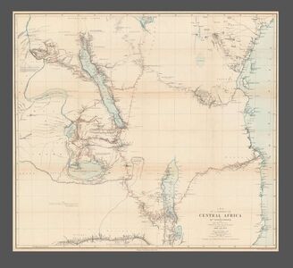
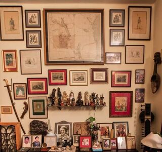
Map of a Portion of Central Africa by Dr. Livingstone from His Own Surveys Drawings and Observations between the Years 1866 and 1873.The map depicts the region of central Africa from the Lualaba River to the Indian Ocean and from Lake Victoria to Lake Shirwa and part of the Zambezi (Zambesi) River, where Livingstone spent the years of 1866 until his death in 1873 along the southern shore of Lake Bangweolo. Dr. Livingstone's route during these years is traced in red, with Livingstone's comments on the landscape interspersed throughout, along with dates when he visited certain locations. Dr. David Livingstone (March 19, 1813 - May 1, 1873) was a Scottish physician, an explorer of Africa, a pioneer Christian missionary and one of the most beloved British heroes of the late 19th century. Livingstone first arrived in Africa in the early 1840s and spent the next two years exploring the Zambezi, eventually becoming the first European to see the Mosi-o-Tunya waterfall, now known as Victoria Falls in the West, which Livingstone named for Queen Victoria. He then returned to Britain and returned in 1857 to pursue scientific exploration and opening Central Africa to commerce, mostly in an effort to end the African slave trade. This map occupies a central position in my drawing room. Dated 1875.